NTH Consultants
Contact Us
  • Home
  • Markets
    • Energy Market
    • Industry Market
    • Water Market
    • Transportation
    • Community Development
  • Services
    • Geotechnical Engineering >
      • Geophysical Services
      • Mapping
      • Shoreline Services
      • Civil Site Engineering and Design
      • Construction Materials & Geotechnical Testing Services
      • Electric Substation Services
      • Geotechnical Engineering for Transportation Facilities
      • Underground Engineering Services
      • Subsurface Utility
      • Signature Projects
    • Environmental Services >
      • PFAS
      • Ecological Services
      • Environmental Health Services
      • Environmental Remediation Services
      • Environmental Compliance
      • Environmental Permitting
      • Environmental Site Assessments
      • Ecological Services for the Energy Market
      • Air Quality Permitting and Compliance
      • Brownfield Site Redevelopment
      • Environmental, Health & Safety Training for Employee Development
      • Hydrogeologic Studies
      • Landfill Related Services
      • Site Acquisition and Redevelopment
      • Storage Tank Services
      • Signature Projects
    • Facilities Engineering >
      • Decommissioning
      • Structural Condition Assessment Rehab
      • Bridge Engineering Services
      • Asset Management Services
      • Concrete Restoration
      • GIS Services
      • Masonry Evaluation Services
      • Pavement Engineering and Consulting
      • Roofing Technology Services
      • Structural Condition Assessment
      • Signature Projects
  • Projects
  • About Us
    • Mission + Core Values
    • Leadership
    • News and Events
    • Employee Portal
  • Webinars
    • Emergency Actions Plans Webinar
  • Careers
    • Why Join NTH
    • Who We Are
    • Career Opportunities
    • NTH Internship Program
  • Blog
  • Contact Us

Infrared Condition Assessment of Bridge Decks and Roadways

5/12/2016

1 Comment

 
Picture
​Recently an article by Steve Nielsen at WPRI, Experts testing X-ray technology that could identify infrastructure damage, discussed "a two-part system that sees through concrete using infrared thermography and ground penetrating radar." Dr. Nicole Martino, an engineering professor at Roger Williams University who is working with the Rhode Island Department of Transportation, was interviewed for the article. He stated that the difficulty with identifying failures in concrete on bridges is that they are often invisible. Using this new technology, engineers can essentially take an X-ray of the bridge which allows workers to see where the damage lies and where work needs to be done. They estimate that this could save millions in time and money. 

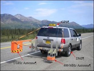
According to Dr. Dawson, this infrared technology is a great way to obtain detailed information on bridge deck conditions that cannot be observed through traditional methods. The technologies rely on differences in the heating rates and density of damaged versus intact concrete structures to identify and quantify potentially damaged areas. The use of infrared thermography and ground penetrating radar on bridge decks is relatively fast and can be performed without having to close lanes to traffic along the bridge.
 
The Michigan Department of Transportation (MDOT) has performed similar inspections on bridges in the Metro and Southwest Regions over the past few years. Infrasense, a Massachusetts based firm, and NTH have performed such inspections on more than 60 bridges along I-75, I-94, I-69, US-131, and other major roadways. The results have supported the selection of cost-effective rehabilitation and maintenance solutions to enhance the longevity of the bridge decks.

1 Comment

A Visit from Engineering Students from the university of Groningen, Netherlands

5/6/2016

2 Comments

 
Picture
Professor Gerd Weitkamp brought three of his spatial development,  urban planning and civil engineering students from the University of Groningen (Netherlands, Europe) to Detroit this week. They are studying the challenge of population decline in Detroit and the spatial solutions for this challenge. They report that from an European perspective, redevelopment challenges in the Detroit are different from challenges in Europe, which makes Detroit such an interesting city for spatial development students.

One of the redevelopment projects they were interested in was the Bloody Run Creek Greenway,  an urban greening project on which NTH Consultants collaborated. We invited them to come into our office for a talk with the Project Manager on this project, Keith M. Swaffar, P.E., our Executive Chairman. 

Keith spoke to the students about the project, the plans and challenges and answered their questions not only about Bloody Run Creek, but also Detroit in general as Keith and NTH have a long history of working on Detroit based projects. The students, Marion Plegt, Martijn de Gruij and Foekje van Schoot, had some great ideas for the city and were very positive about what they have seen and heard about Detroit.
​​Overview of the Bloody Run Creek GreenWay Redevelopment Project
Picture
Historically, the Bloody Run Creek existed immediately north of downtown Detroit and discharged into the Detroit River. The creek’s name stems from a Native American ambush of British soldiers in 1763. The creek originally served as transportation and water supply for the French ribbon farms that lead to settling the area in the 18th century. By the late 19th century, health issues in the city called for sewering the creek; burying it almost entirely in culverts by 1890. Today, only a small reach of the original creek remains, running through the historic Elmwood Cemetery. 

Working with the Detroit Collaborative Design Center (DCDC) at the University of Detroit Mercy, NTH lead the initial engineering planning and concept development phases to evaluate the feasibility and engineering requirements associated with “daylighting” the creek to serve as a stimulus for the redevelopment of a large portion of the City’s east side. The conceptual creek alignment shown to the left includes a daylighted creek of over 37,100 lineal feet.

2 Comments

How will the 2017 Renewal of the Stormwater General Permit for Construction Activity impact your business? 

5/2/2016

0 Comments

 
Picture
As part of their impending 2017 renewal of the Stormwater General Permit for Construction Activity (CPG), the US EPA is proposing multiple changes to the permit conditions.  
 
The proposed permit includes several minor new or modified requirements and they involve much more than erosion control. The following summarizes the proposed changes to the CGP.
 
  1. Streamlining of Proposed Permit. EPA proposes to streamline and simplify language throughout the CGP to present requirements in a generally more clear and readable manner.
  2. Types of Discharges Authorized. EPA authorizes several non-stormwater discharges associated with construction activity under the 2012 CGP in Part 1.2.2.  EPA proposes to require that authorized non-stormwater discharges of external building washdown waters will not be authorized to contain hazardous substances, such as paint or caulk containing polychlorinated biphenyl (PCBs).
  3. Effluent Limitations. EPA proposes to make minor revisions to the technology-based effluent limits in the proposed permit to implement the 2014 amendments to the C&D (Construction and Development) rule.
  4. Public Notice of Permit Coverage. Construction operators will be required to post a sign or other public notice of permit coverage at a safe, publicly accessible location in close proximity to the construction site, as in the 2012 CGP. EPA proposes that this notice will also be required to include information informing the public on how to contact EPA if stormwater pollution is observed in the discharge. EPA is proposing to require this condition to improve compliance with the permit.
  5. Stockpiles and Land Clearing Debris Piles. EPA proposes to change the requirement for temporary stabilization for stockpiles or land clearing debris piles from “where practicable” to requiring cover or appropriate temporary stabilization for all inactive piles that will be unused for 14 or more days, consistent with the temporary stabilization deadlines in the proposed permit. EPA is proposing this change to ensure pollutants are minimized from these piles, but is clarifying that the requirement only applies where these piles are not actively being used.
  6. Construction and Domestic Waste. EPA proposes to require waste container lids to be kept closed when not in use, or, for waste containers that do not have lids and could leak, EPA proposes to require cover or a similarly effective means to be provided to minimize the discharge of pollutants. EPA proposes this change to make the requirements for construction and domestic waste consistent with the cover requirements for most other types of materials and wastes in the 2012 CGP.
  7.  Pollution Prevention Requirements for Demolition Activities.  Operators will be required to implement pollution prevention controls to minimize the discharge of pollutants in stormwater and to prevent the discharge of pollutants from spilled or leaked materials from construction activities. In order to ensure that discharges meet water quality standards, EPA proposes a requirement to implement controls to minimize the exposure of polychlorinated biphenyl- (PCB) containing building materials to precipitation and stormwater. This proposed provision would only apply to structures with at least 10,000 square feet of floor space built or renovated before January 1, 1980.
  
For more details, see the US EPA web site click here.
 
If you need help determining how these proposed changes will impact your business, feel free to contact:
  • Brad Venman, NTH Lansing, MI at (517) 881-0335
  • David Lomas, PE, QEP, NTH Northville, MI (248) 662-2759
  • Patrick Nortz, CPG, PE, NTH Cleveland, OH at (216) 344-4048
0 Comments

Improving Directions from the Heavens Above:  Modernizing the American Global Positioning Systems (GPS)

5/2/2016

0 Comments

 
Picture
PictureBy Jeff Kodysh, GIS Analyst at NTH Consultants, Ltd
One of the most important 20th century technological innovations was the American development of the Global Positioning System – or GPS for short. This system, consisting of a space-based constellation of approximately active 24 satellites beaming radio waves to the ground, allows users on the ground to accurately and precisely determine their location on earth’s surface. Originally intended for the military purposes, it has today blossomed into a key technology with an ever-growing list of end-users in fields as diverse as telecommunications to civil engineering. 

The world quite literally depends on GPS, and we aren’t going to abandon the system anytime soon. Besides its original defense purposes and the perhaps incalculable scientific value of being able to accurately say where something or someone is located on the earth, there are strong economic benefits to having a functioning GPS system. The government now estimates the economic value GPS system to be between $37.1 and $74.5 billion dollars, depending on how the calculations. This value will only continue to rise as GPS-using technologies become more and more ingrained our society via the use of smartphone applications and other geo-aware devices. In fact, GPS is so important to our daily lives that we have decided to invest billions of dollars into an improved GPS system called GPS III to replace our nation’s aging satellite constellation.
 
At its fundamental core, GPS is really quite a simple concept. It relies upon the known locations of the satellites in space and extremely accurate onboard atomic clocks to allow radio signal receiving units on the ground to “triangulate” locations based on this known information. The satellite constellation above the earth constantly broadcasts radio signals towards the earth’s surface with the current time and their position in relation to the earth. A receiver GPS unit on the ground captures these signals from multiple satellites and simultaneously solves for an unknown location using the precisely known locations of the satellites and the slight differences in radio signal travel times.

In reality, building, maintaining, and utilizing a functional, accurate GPS system is quite a bit more complicated than its theoretical fundamentals. It is a multibillion dollar technical endeavor involving dozens of different companies and is headed up by hundreds of scientists and engineers working with the United State Air Force. 

A GPS provides accurate measurements at the planetary scale, with FAA data showing normal global civilian performance of the current system with approximately 3.8 meters of horizontal error as opposed to real life. This limitation occurs because of many different factors, including radio signal attenuation, interference from trees and buildings and other features, and the arrangement of satellites in the sky as related to the GPS receiver on the ground. Another large limiting factor for civilian applications of GPS is the fact that civilian users may only access one radio frequency versus two frequencies for military users.
This sort of accuracy is often more than enough for some applications – tracking a ship as it crosses the ocean, for example. 3.8 meter accuracy is not, however, good enough for applications of GPS technology that require centimeter or millimeter levels of accuracy, such as the precise grading of roadbeds. 

Currently, civilian improvement of this accuracy is possible through the use of ground based technologies like the Nationwide Differential GPS (NDGPS) and the Continuously Operation Reference Stations (CORS) systems. These systems already allow for marked improvement of accuracy down to the millimeter level, but they have a large flaw in that they are not established evenly across the entire world. There are large “blind spots” where GPS can’t reliably deliver more accuracy than the previously mentioned 3.8 meter figure. 
​
Our nation’s GPS capabilities will be markedly improved as the GPS III modernization process moves forward. Future improvements will allow civilian users to access multiple radio frequencies like military users, eliminating these blind spots. Additionally, GPS III will help usher in a system of signal standardization for incorporating other GPS constellations signals, like the EU’s Galileo GPS system. Altogether, GPS III will provide users with up to a three-fold improvement in accuracy, reduction of the ground-system dependent “blind spots”, along with vital improvements in anti-signal jamming technologies, a huge technological leap forward compared to current system.  

Picture
0 Comments

    The NTH Narrator

    NTH Consultants, Ltd. (NTH) is a nationally recognized engineering firm specializing in Civil, Geotechnical, Environmental, and Facilities Engineering. 

    On our blog, our engineering experts address current news and events in our field, review new projects and highlight NTH news.

    Tweets by @nthconsultants

    RSS Feed

    Archives

    November 2022
    September 2022
    August 2022
    July 2022
    June 2022
    March 2022
    February 2022
    January 2022
    November 2021
    August 2021
    June 2021
    May 2021
    April 2021
    March 2021
    February 2021
    January 2021
    December 2020
    November 2020
    October 2020
    June 2020
    May 2020
    March 2020
    January 2020
    December 2019
    November 2019
    October 2019
    September 2019
    August 2019
    July 2019
    June 2019
    May 2019
    April 2019
    March 2019
    February 2019
    January 2019
    November 2018
    October 2018
    September 2018
    August 2018
    July 2018
    June 2018
    May 2018
    April 2018
    March 2018
    February 2018
    January 2018
    December 2017
    November 2017
    October 2017
    September 2017
    August 2017
    July 2017
    June 2017
    May 2017
    April 2017
    March 2017
    February 2017
    January 2017
    November 2016
    September 2016
    August 2016
    July 2016
    June 2016
    May 2016
    April 2016
    March 2016
    February 2016
    January 2016
    December 2015
    November 2015
    October 2015
    September 2015
    August 2015
    July 2015
    June 2015